Catalogue PIGMA
/Processed data/Indicators
Type of resources
Available actions
Topics
Keywords
Contact for the resource
Provided by
Years
Representation types
Update frequencies
status
Scale
-
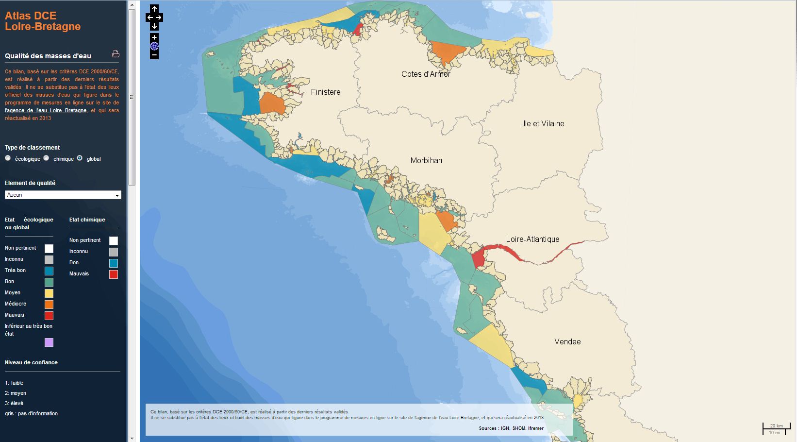
The analysis concerns the assessment of the overall state of the coastal and transitional waters of the Western Channel and the Bay of Biscay. It results from the combination of the ecological status and the chemical status of each water body according to the rules of the European Water Framework Directive (WFD). The most recent assessment of the state is presented in the DCE Loire-Bretagne atlas. Earlier reports are available in annual archives.
-
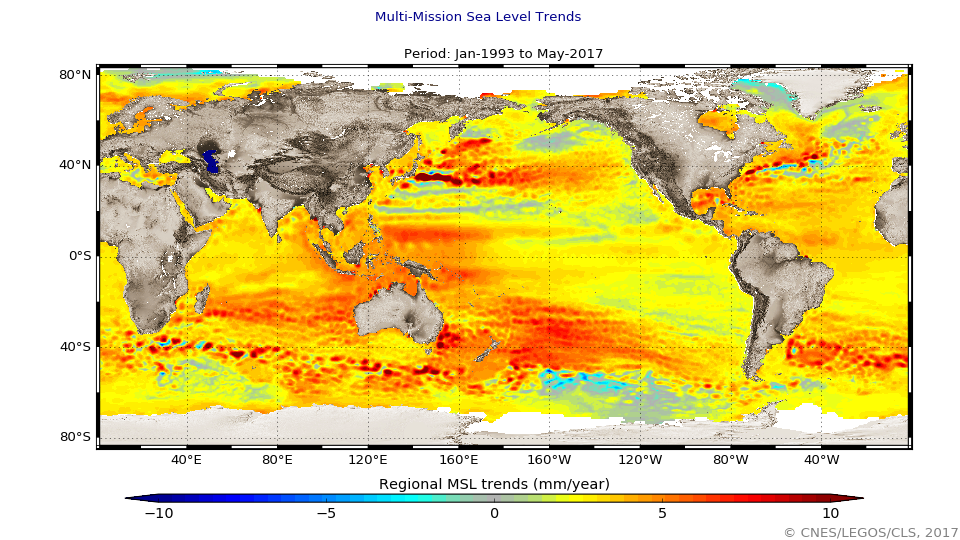
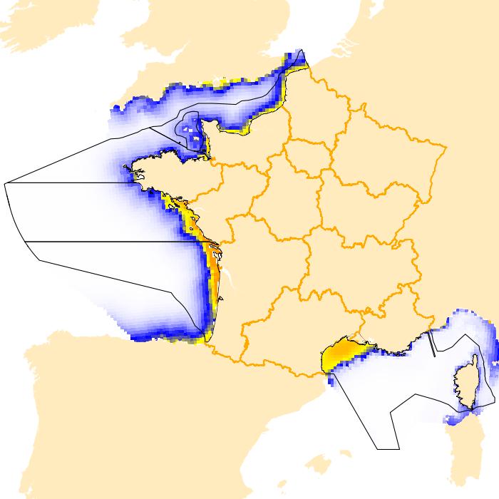
The global mean level of the oceans is one of the most important indicators of climate change. It incorporates the reactions from several different components of the climate system. Precise monitoring of changes in the mean level of the oceans, particularly through the use of altimetry satellites, is vitally important, for understanding not just the climate but also the socioeconomic consequences of any rise in sea level.
-
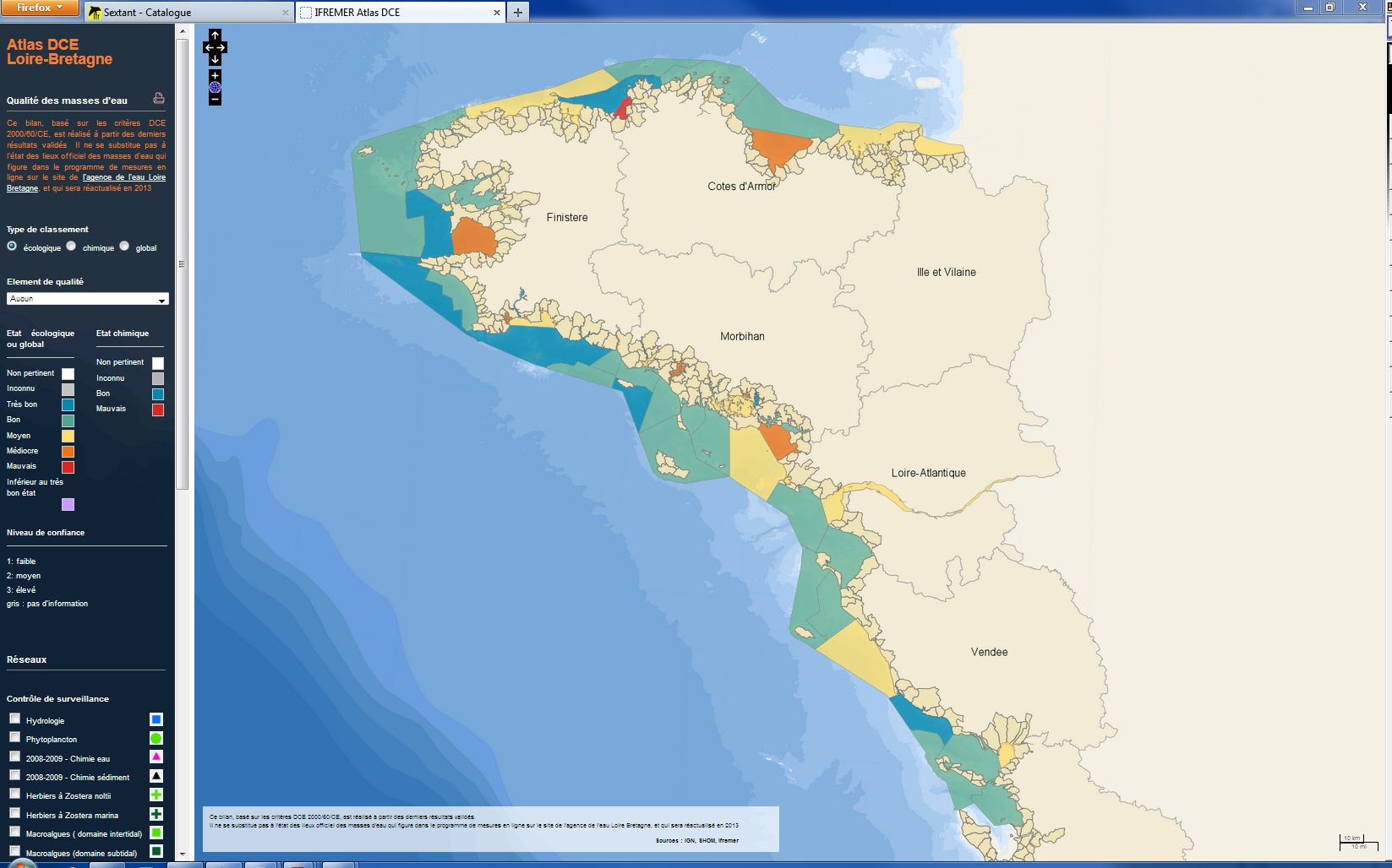
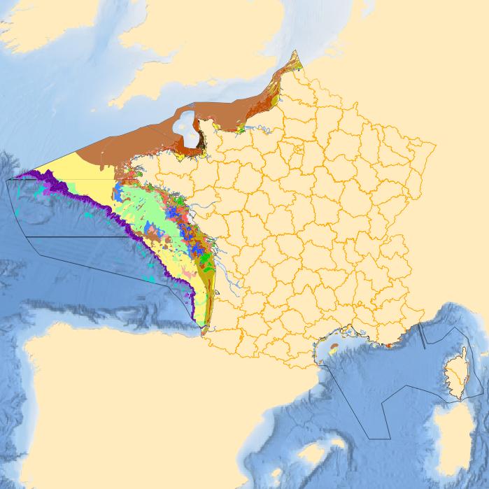
The analysis focuses on monitoring the ecological status of the coastal and transitional waters of the Western Channel and the Bay of Biscay. The ecological status of a coastal water body within the meaning of the European Water Framework Directive (WFD) is determined by the biological state, physicochemical state and hydromorphological state of the water mass, water. The statement is determined according to the rules described in the decree of 25 January 2010.
-
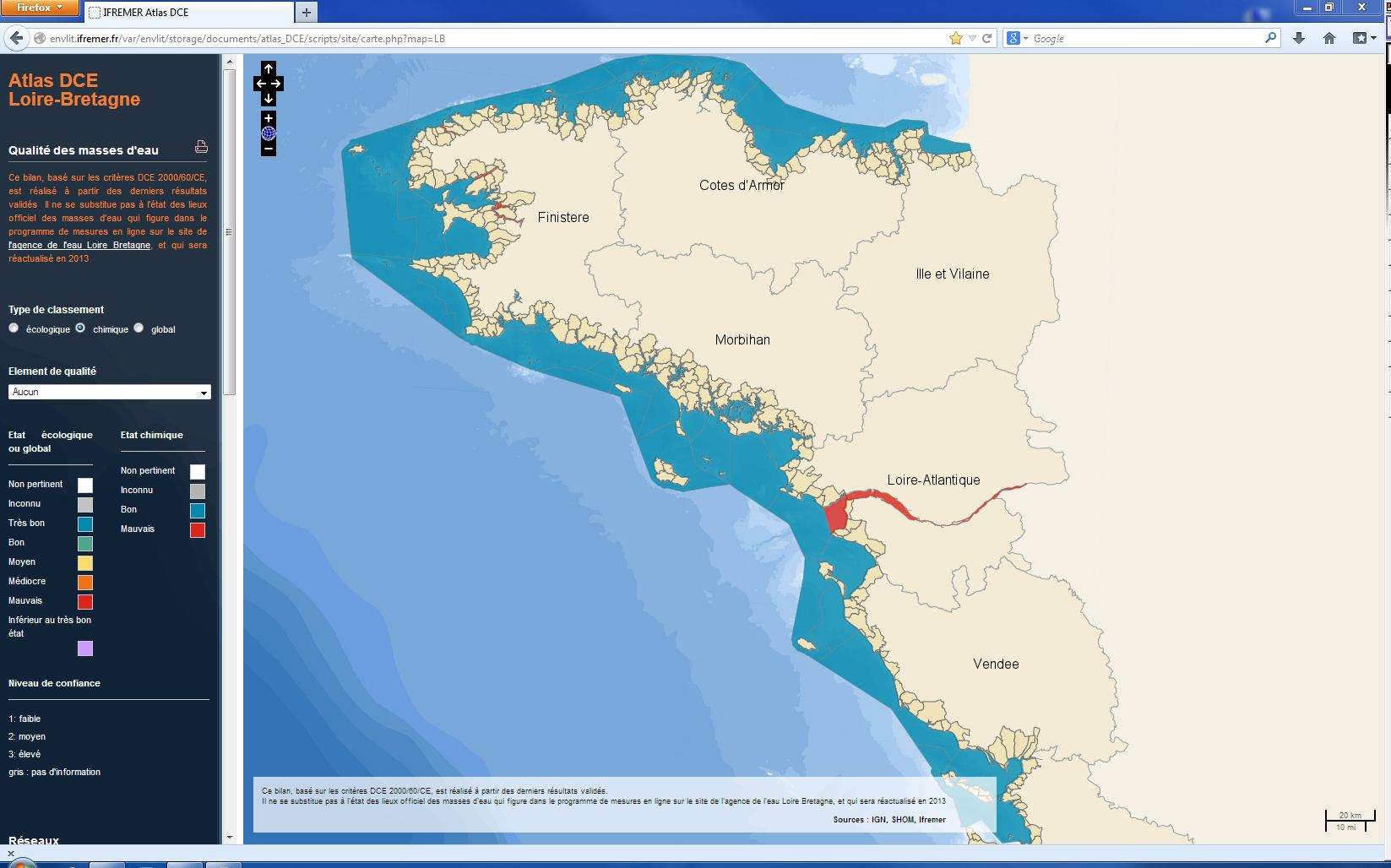
The chemical status of a coastal water body (coastal water or transition water) is determined by the most declassing of the defined states for heavy metals, pesticides, industrial pollutants and other pollutants taken into account by the WFD . The assessment is done once per management plan (once every six years). The most recent assessment of the state of the chemical state is presented in the DCE Loire-Bretagne atlas. Earlier reports are available in annual archives.
-
-
-
-
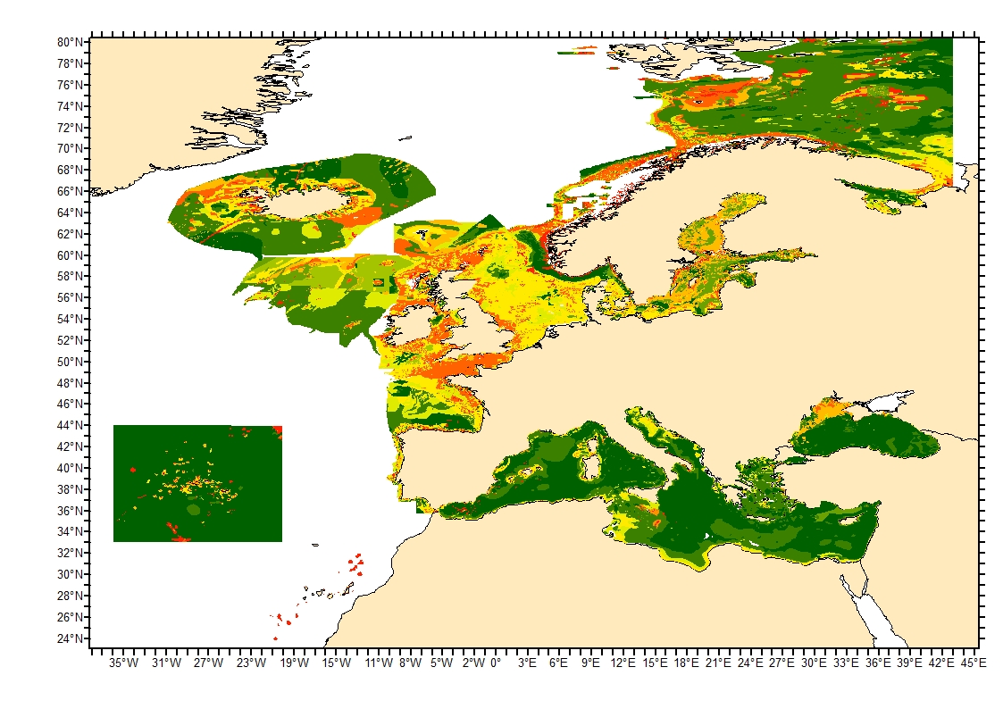
Sediment average grain size in the European North-East Atlantic and Mediterranean waters was generated from Euseamap 2023 sediment categories. This rough granulometry estimate may be used for habitat models at meso- and large scale.
-
-